
|
|
|
|
Interactive Map To Accompany For Those In Peril On The Sea
Spoiler Alert: This page is intended for people who have already read For Those In Peril On The Sea, and may contain information that spoils your enjoyment of the story if you have not done so yet.
NOTE: The Google Earth widget used to display the map will not work on mobile devices (such as a tablet or a smartphone) running on an Android Operating System. Click here to find out how you can view the interactive map on such mobile devices.
How To Use The Map:
NOTE: It may take up to 20 seconds for the map to appear in this window. If it doesn't appear or you get an error message, click here.
Viewing This Map On A Mobile Device: If you wish to view this interactive map on a mobile device that it running the Android Operating System (such as a Google Nexus, a smartphone or a tablet), you will first need to download the Google Earth Mobile App (it's free and really cool). For other smartphones you can download it from here, while for Apple products (iPhone, iPad etc) you can down load it from here. Once you have done this, you can click on one of the links below to view the section of the map that accompanies a specific chapter. When asked where you want to display it, select Google Earth. This will open the Google Earth Mobile App and you will then be able to zoom in and out to explore the locations where the book is set. If you click on any of the coloured dots, a text window will open that provides a short synopsis of the events from the book that were set there. To open another map section, simply return to your browser click on the new chapter's name and it too will be plotted in Google Earth. To clear the maps from Google Earth, simply click the 'CLEAR MAP' button at the top right hand corner of the Google Earth app window.
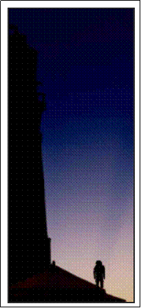
Chapter One - Crossing The Atlantic Chapter Two - The Incident At Hole-in-the-Wall Chapter Seven - Tin Can Roulette Chapter Nine - The Hope Town Community Chapter Ten - Dan, Kathy And David Chapter Eleven - Andrew's Tale Chapter Twelve - Cruiser's Net Chapter Thirteen - The Garden Boats Chapter Fourteen - The First Hurricane Chapter Fifteen - The Girl On The Beach Chapter Sixteen - The Container Chapter Eighteen - Escape From The Lighthouse Chapter Nineteen - The End Of Hope Town Chapter Twenty - The Departure
Alternatively, you can download a zipped folder containing all the individual sections of the map by clicking here. To view the map sections, extract the contents of this folder using an app such as ASTRO File Manager. This will give you a separate map file for each chapter (they will have the extension .KMZ). To view a section of the map, just click on its name. This should open Google Earth and plot the contents of the map in it. To open another map, simply click on its name and it too will be plotted. To clear the maps from Google Earth, simply click the 'clear map' button at the top right hand corner of the Google Earth app window.
If you would be interested in having a similar custom-designed, interactive map for your own book, website or for any other purpose, please email info@forthoseinperil.net to discuss this possibility. |
|
All material on this website is copyright 2013 Colin M. Drysdale. This copyright applies worldwide as well as on the internet. While every effort has been made to ensure that the content of this website is accurate, it is provided on an 'as is' basis and there is no guarantee that it is correct. While you are welcome to consult this material while on this website, please do not copy it for use on other websites or for any other purpose without express written permission. Any links to this material from websites other than those of ForThoseInPeril.net must use 'Unmasked Forwarding' so that the original source of this information is clear at all times. In addition, this information should not be used for commercial purposes without prior consent. To discuss any copyright issues, including permission to use information from this website for other purposes, please email info@ForThoseInPeril.net
Send mail to
webmaster@ForThoseInPeril.net
with questions or comments about this web site.
|
 While the story and characters that feature in
For Those In Peril On The Sea are fictional, the book is set in the real
landscape of the northern Bahamas, particularly around the islands of the Abacos.
To allow you to explore this landscape in more detail, we have created an
interactive map that can be displayed in
While the story and characters that feature in
For Those In Peril On The Sea are fictional, the book is set in the real
landscape of the northern Bahamas, particularly around the islands of the Abacos.
To allow you to explore this landscape in more detail, we have created an
interactive map that can be displayed in

 Alternative Ways Of Viewing The Interactive Map:
If you have Google Earth installed on your computer and wish to use it to view
this information, you can download the map by clicking
Alternative Ways Of Viewing The Interactive Map:
If you have Google Earth installed on your computer and wish to use it to view
this information, you can download the map by clicking